My Custom Maps
Latest Butler Creek Map
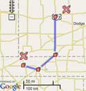
Here is the
latest custom Google map
of Butler Creek. Besides correctly
showing properly named roads, you can search for a specific address or property owner.
Teton Co. Address Map
I've been learning how to create custom mapping for Garmin Map GPS receivers.
My first serious attempt was to map all the addresses in Teton County, WY. This is the result.
If you live or work in Teton County, or know someone that does, and you own a Garmin Map GPS
receiver, you may be interested in this. It is free for personal use. There is a fee for use
by businesses in Teton County or the surrounding area. Other commercial use is prohibited. Just
download and extract the
ZIP file
(792KB via Google Sites 'attachment'), then follow the
included instructions. If you would
like to make your own custom maps, there is a resource list in the documentation.
Powodzenia!
("Good Luck!" in Polish. The primary hacker of the Garmin map format
was a Pole, Stanislaw Kozicki.
Archives
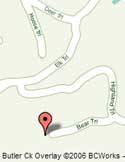
The Corrected Map
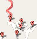
Here is my
corrected map
of my neighborhood. I configured it to show outside pages and place markers based on URL
parameters so that my neighbors could use my map with their own set of directions. Here is a
sample.
NOTE: This post uses the deprecated v2 of the Google maps API. Google has scheduled
the cessation of v2 function on 19 May 2013
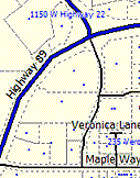
Google Tiles
I then discovered that I could make my own overlay map that would show the
correct roads and names in my neighborhood. I built
this tool
to understand how Google's tiling system works
so that I could overlay my own map.
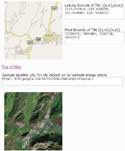
Bouncing Marker
 This page
is just a basic test bed for developing
custom map markers that appear in the page mentioned previously. I learned
a couple key things that were not documented. One is that marker icon
coordinates are base 0, not base 1 as mentioned by other Google mappers.
The other is that the X position of the dragging marker is relative to the
bottom right corner of the main icon image, even though everything else is
relative to the top left corner. Update: As of version 2.61, the X position
placement method was changed to something more intuitive.
This post uses the deprecated v2 of the Google maps API.
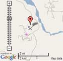
Waypoints and Routes
I then built
this tool
to glean coordinate information from the map. I also had the idea of importing and exporting
information from my GPS, but that functionality is available elsewhere, so
this page became a low priority, and I'm still working on it off and
on.
This post uses the deprecated v2 of the Google maps API.
Hello World
My interest in customizing Google maps came about from the fact that few of
the roads in my neighborhood are accurately mapped. Some roads don't exist,
and other roads are completely misnamed. My
first attempt
at Google mapping is just a map showing the problems in my
neighborhood.
This post uses the deprecated v2 of the Google maps API.
